8. If The MH370 Submerged In
The Gulf of Thailand – Summary and Conclusion
8.如果MH370沉浸在泰国湾 - 摘要与结论
Nam Fong (Malaysian)
南方 (马来西亚人)
Draft and to be continued….
初稿与待续……
Introduction 前言 (22-5-2014,
2014 年5月22日)
It has been more
than 2 months (75 days) since the MAS flight MH370 missing on March 8, 2014.
The incident has led to the biggest search operation in the history of
aviation, which involved many countries’ mobilization to help, a total of 26 countries
were officially participated in the search, deployed many airplanes, military
aircrafts, naval ships, ships, radars, various types of undersea facilities and
equipment etc., besides many official investigation experts involved directly
and indirectly, there are countless of governmental and private organizations’
or personal involvement.
马航班机MH370自2014年3月8日失踪以来已经超过2个月(75天). 这起事故已导致航空史上最大的搜寻行动, 涉及许多国家动员协助, 一共有26个国家官方参与搜寻, 派遣了很多飞机, 军机, 军舰,
船只, 卫星,
雷达, 各种海底探测仪器等等, 除了许多官方调查的专家直接与间接参与, 那些政府和私人机构或个人的参与则不计其数.
Since the incident
occurring I have already realized that the aircraft is submerged in the Gulf of
Thailand, if the search operation was continued in the Gulf of Thailand, with
change of location and strategy, I guess it would be found in 3 more days, if
lucky it might need less than 24 hours to find it. Unfortunately, speculations emerged
that the aircraft flew westerly, resulted the whole search and rescue operation
in the South China Sea was completely cancelled, the attention was shifted to
the seas at northwest of peninsular Malaysia, and later searching was focused
on the middle Indian Ocean, till now is still in progress, this is all due to
the ping signals detected by the Inmarsat (International Marine and Satellite
Organization), the representative of the organization remains very confident to
say that it was emitted by the MH370 aircraft. Because of that, the earlier
one-week search and rescue operation in the South China Sea was condemned by
all parties as wasting time and money and manpower, after that no one else dare
to mention stay on searching in the South China Sea. The consequence is, the
whole incident has become very strange, even said to be the most mysterious
missing aircraft incident in the aviation history, but, if the aircraft is
submerged in the Gulf of Thailand, that would not be mysterious incident,
instead it should be the unprecedented most bungled investigation, most clumsy
media reports, and most messy public comments.
打从事故发生后我就已意识到飞机是沉浸在泰国湾, 如果搜寻行动有在泰国湾持续下去, 改变搜寻地点和策略, 我猜想只需再多3天就能找到的, 幸运的话无需24小时就能寻获. 很可惜, 后来出现了飞机西航的揣测, 把整个在南中国海的搜救行动彻底取消, 注意力转移到半岛马来西亚的西北部的海域, 和后来的搜寻集中于中印度洋, 至今还进行着, 这全归咎于英麻协(国际海事卫星组织)所提出的探测到的频音信号, 该机构的代表非常自信地断言那是由MH370飞机发出的. 由此,
之前在南中国海的一个星期搜救行动就被各方谴责为浪费时间和金钱人力, 之后再也没人敢提起留在南中国海搜寻. 结果呢, 整个事故变成很诡异, 还被称为是航空史上最离奇飞机失踪案例, 但是, 如果飞机沉浸在泰国湾, 那它就不是离奇事故, 相反的应该是史无前例摆最大乌龙的调查, 最糊涂的媒体报导, 和最糟糕的民众舆论.
(O) Aircraft Wreckage is Not Found in the “Roaring 40” Zone.
(O) 在“哮吼40”地带没有发现飞机残骸.
Source of diagrams: Internet Google search
images. 图片来源: 网络谷歌搜寻图像.
Eastern Indian Ocean flight path diagram 东印度洋的航道图
Reason 13. Raw data is something that can be given off hand immediately, if you want to, but after more than 2 months, it is still exclusively in possession by Inmarsat, it may be an indication of worry as they may face massive critiques from all over the world.


Source of diagrams: Internet Google search images. 图片来源: 网络谷歌搜寻图像.
(13) Well, let’s see how the investigators analyze the first handshake signal data at 2:27 am as given in the eastern Indian Ocean flight path diagram. The so-called first handshake is actually consisting of three data points between 2:23 am and 2:29 am, as shown in the graph of burst frequency offset against time, which shows a consistent drop in the BFO, with the first point having BFO about 272 Hz, second point BFO about 175 Hz and the third point BFO about 142 Hz (estimation from graph). However, in the satellite data report there is a range of fluctuation of BFO values during the time between 2:25 am to 2:28 am; among these series of data, the 3 graph points closely correspond to 3 selected satellite data are: 2:25:34 am and 273 Hz, 2:27:08 am and 172 Hz, 2:28:14 am and 143 Hz. There are only 3 data points selected (although there is some minor discrepancy in time), which should be having some significant meaning to the investigators.
18 June 2014 (2014年6月18日)


Source: Satellite data report and Australian Transport Safety Bureau.
Since April 21, I
have published 7 articles, analyzed the tracks and ways of the whole incident from
various angles, including sighting witnesses, location and time of lost
contact, the detection of radar blips and the reception of satellite’s
handshake ping signals, and the speculation of Indian Ocean flight path theory.
As time goes on, there were some new information and data emerging, so I have
also updated some of my follow-up of the incident in order to get the right hypothesis
and conclusion as accurate as possible. In recent days there are some doubts in
the Inmarsat satellite’s data, and some next-of-kin have requested Inmarsat
investigation group and Malaysian authorities to release the raw data, this is
what public people awaits for.
自4月21日以来,
我已经刊登了7篇文章,
从各种角度分析整起事件的来龙去脉, 包括目击者,
失联时间和地点, 雷达咇声探测和卫星的握手频音信号接收, 和印度洋航道的理论的揣测. 随着时间的前进, 出现了某些新的资料和数据, 因此我也更新某些与事故的跟进以及尽可能达到更准确的推论和总结. 近日来出现了一些对英麻协卫星的数据起了质疑, 一些家属并要求英麻协调查团和马来西亚当局公布原生数据, 这是民众所期待的.
Here I will first
rearrange the points discussed before and to make some summary and conclusion,
I will begin the analysis from the place farthest from the starting point of aircraft
missing, that is the southern Indian Ocean at the southwest of Australia, then
go backward and return to the original spot of incident, that is the Waypoint
IGARI.
在这里我将先重新整理之前讨论过的论点和做一些概要和结论, 我将从离开飞机失踪起点最远的地方, 既是澳洲西南方的南印度洋开始分析, 然后倒退回到事发的原始点, 既是伊嘎里航点.
(O) Aircraft Wreckage is Not Found in the “Roaring 40” Zone.
(O) 在“哮吼40”地带没有发现飞机残骸.
(1) According to a
media report, on March 14, the US Pentagon indicated that MH370 might have
crashed in the Indian Ocean. On March 15, there was an announcement that the
MH370 might have gone into two possible corridors, the northern corridor is
basically the middle Asia mainland, and the southern corridor is largely the Indian
Ocean, several countries had then directed their satellites to the Indian Ocean
to search for any sign of the aircraft wreckage. Australia was the first to
announce that its satellite had sighted (on March 16) large floating object in
the southern Indian Ocean, about 2,200-2,500 km southwest from Perth, in later
days, similar claims at the same region were also made by other countries. On
March 24, it was announced that the position where the MH370 ended its flight was
thought in the southern Indian Ocean, the conclusion was based on the analysis
of ping signal data detected by Inmarsat’s satellite, made by investigators including
experts from the UK’s Air Accidents Investigation Branch (AAIB), staff from
Inmarsat, etc.
(1) 根据一则媒体报道, 于3月14日, 美国五角大楼表明MH370可能已在印度洋撞毁. 于3月15日, 有一则宣称MH370可能进入两个可能的走廊, 北部走廊基本上是亚洲中部大陆, 和南部走廊大致上是印度洋, 数个国家后来就将他们的卫星导向印度洋以寻找任何飞机残骸的迹象. 澳洲就是第一个宣布其卫星有观测到(于3月16日)在南印度洋有大件漂浮物, 在柏斯西南方大约2,200至2,500公里, 后来几天,
其他几个国家也在同样的地区做类似的宣称. 于3月24日, 宣告MH370终结其飞行的位置是在南印度洋, 该结论是根据英麻协卫星探测到的频音信号数据, 由调查员所做的, 包括来字英国航空意外调查局, 来自英麻协的职员等等.


Source of diagrams: Internet Google search
images. 图片来源: 网络谷歌搜寻图像.
Reason 1. After visual searching on the sea surface for several days, not even one
piece debris of MH370 was found in the “roaring 40” zone. So, MH370 aircraft did
not crash there.
理由1. 经过海面上视觉搜寻几天后, 在“哮吼40”地带连一块MH370的碎片也没被发现. 因此,
MH370飞机没在那儿撞毁.
(2) The distance
from Kuala Lumpur to Perth is about 4,200 km, a flight’s travel time is 5.5
hours and average speed is about 760 km/h. The distance from Andaman Sea to the
“roaring 40” zone is about 5,500 km, if the flight’s average speed is about 760
km/h, then it would need more than 7 hours. If the aircraft travelled from Andaman
Sea at about 2:30 am and ended at “roaring 40” zone at about 8:19 am, then the
average speed required would be about 945 km/h.
(2) 从吉隆坡去柏斯的距离大约4,200公里, 一个航班的时间是5.5小时以及平均速度760公里时速.
从安达曼海去“哮吼40”地带是大约5,500公里, 如果航机的平均速度是大约760公里时速, 那它就需要超过7个小时. 如果该飞机于凌晨2时30分从安达曼海航行以及早上8时19分在“哮吼40”地带终结, 那么所需的平均速度将会是945公里时速.
Source of diagrams: Internet Google search
images. 图片来源: 网络谷歌搜寻图像.
Reason 2. Based on the time-distance-speed calculation, if the aircraft travelled
at 760 km/h, it should reach the “roaring 40” zone at the time of 9:30 am but not
8:19 am; if it reached there at 8:19 am, its speed 945 km/h would be unusually
much higher than its normal average high speed; either one could not be
tallied. So, MH370 did not end at the “roaring 40” zone.
理由2. 根据时间-距离-速度的计算, 如果该飞机以760公里时速航行, 它到达“哮吼40”地带的时间应该是早上9时30分而不是早上8时19分; 如果它于早上8时19分抵达那儿, 它的速度945公里时速将是不寻常的太过高出它的正常平均高速; 两者都不能符合一致. 因此, MH370没有在“哮吼40”地带终结.
Reason 3. Although the aircraft’s fuel data is not released in the preliminary
report for the MH370 missing incident, and it might be an issue of uncertainty,
some media information reported that its fuel might be enough for it to fly for
8 hours. Based on the time-distance-speed calculation, the aircraft was unlikely
to have enough fuel for it to reach the “roaring 40” zone at 9:30 am. So, the
MH370 cannot reach there.
理由3. 虽然在MH370失踪事故的初步报告中没有公布飞机的燃油数据, 况且它可能是个不确定的课题, 某些媒体的情报报道称其燃油或许足够让它飞行8个小时. 根据时间-距离-速度的计算,
该飞机不像有足够的燃油让它于早上9时30分抵达“哮吼40”地带. 因此,
MH370不会抵达那里.
(3) Aircraft’s
wreckage was not found in the “roaring 40” zone, black box’s signals also not
detected there. The search operation was then moved northeast, to an area about
1600 km on the west of Perth, around 30oS and 100oE,
about 4,400 km from Andaman Sea. If the flight’s average speed was about 760
km/h, then it would need about 5.8 hours. If the aircraft travelled from
Andaman Sea at about 2:30 am and ended at the 30oS zone at about
8:19 am, then the average speed required would be about 755 km/h. These are the
most reasonable time-distance-speed data.
(3) 在“哮吼40”地带找不到飞机残骸, 在那儿也探测不到黑箱的信号. 搜寻行动就向东北推移, 到离柏斯西边约1,600公里的区域, 南纬30度和东经100度周围, 离安达曼海约4,400公里. 如果航机的平均速度是大约760公里时速,
那它就需要约5.8个小时.
如果该飞机于凌晨2时30分从安达曼海航行以及早上8时19分在南纬30度地带终结,
那么所需的平均速度将会是约755公里时速.
这些是最合理的时间-距离-速度数据.
Reason 4. Although it is most logical for the aircraft to reach the 30oS
zone, but debris is not found, black box’s signals also not detected in this
region, but further northward. So, MH370 did not crash there.
理由4. 虽然飞机抵达南纬30度地带是最合逻辑的, 但是碎片没被找到, 黑箱的信号也没在这区域被探测到, 而是更偏远于北部. 所以, MH370没在那儿坠毁.
Reason 5. As the search was further shifted northeast, on April 5, undersea ping signals
were claimed detected by the Chinese ship HaiXun 01 at the region of about 25oS,
but debris also not found there, and the relationship of the signals with MH370
black box was then rejected by investigators, because the Australian search
team claimed to have detected more reliable ping signals in the further
northern region. So, MH370 did not crash in the 25oS zone.
理由5. 当搜寻再向东北推移, 于4月5日, 在大约南纬25度的地区,
中国船舰海巡01号宣称探测到海底频音信号, 但是在那里也是没有找到碎片, 而且信号和MH370黑箱的关系后来被调查员排除, 因为澳洲搜寻队宣称在更北部地区探测到更可靠的频音信号. 所以,
MH370没在南纬25度地带坠毁.


(P)
Aircraft Wreckage is Not Found in the Middle Indian Ocean. (26-5-2014).
(P)
在中印度洋没有发现飞机残骸. (2014 年5月26日).
(1) When the
Australian ship Ocean Shield claimed to have detected ping signals on April 5
in the region around 20oS 104oE, visual sea-surface
search and underwater search were immediately intensified in the region (I
named it middle Indian Ocean because it is not so far southward). It has then
become the highest probability area as appeared in the flight path diagram
released together with the preliminary report about MH370 incident. It seemed a
bit manifest of “canon behind horse”, because the theoretical flight paths proposed
by investigators was presented after some physical search findings obtained by
search teams, likely relying on other backups.
(1) 当澳洲的船舰海洋之盾号声称于4月5日在南纬20度东经104度周围区域探测到频音信号, 在该区域的海面视觉搜寻和水底搜寻即刻被加强(我称它为中印度洋因为它不是太南端). 它后来就成为既如和MH370事故初步报告一起公布的航道图里出现的最高可能性地区. 这似乎显得有点“马后砲”, 因为由调查员提议的理论航道是在搜寻队获得某些搜寻发现后才提出, 好像是在依赖着别的备撑.
Reason 6. The analysis method that has not before used, but used for the handshake
ping signals detected by the Inmarsat satellite, it does not prove to be fully
independent or reliable, the raw data hold by Inmarsat are not released to-date
(26-5-2014), may indicate a cover-up of its unreliability. So, saying the MH370
in the middle Indian Ocean is questionable.
理由6. 那个前所未用过的分析方法, 不过却用于英麻协卫星探测到的握手频音信号, 这不能证明是完全独立性和可靠的, 那些英麻协持有的原生数据至今(26-5-2014)还没公布, 可能就表示为其不可信度而有所隐瞒. 因此, 说MH370在中印度洋是有问题的.
(2) In my previous
article, I have mistaken the units “nm” as nanometers, it should be nautical
miles. I will make new interpretation of the data given in the flight path
diagram. When the search in the roaring 40 zone was cancelled, one of the
reasons given was that, the aircraft could have travelled faster, fuel finished
earlier, thus the journey should be shorter, so it would be further northward.
(2) 在我的上一篇文章, 我错误的把“nm”的单位当做纳米, 它应该是海浬. 我将对航道图所给的数据做出新的诠译. 当在“哮吼40”地带的搜寻被取消时, 所给的理由之一是, 该飞机可能航行的更快, 燃油更早耗尽, 因此行程应该比较短, 所以它应该 在比较远北处.
Reason 7. The aircraft travelled from Andaman Sea at about 2:30 am, ended at about
8:19 am, if it ended at “roaring 40” zone, the average speed required would be
about 945 km/h; if it ended at the 30oS zone, the average speed
required would be about 755 km/h, however, the speed range to end at more
northward middle Indian Ocean (20oS zone) as given in the flight
path diagram is 322-350 knots (600-650 km/h), the simulated speed become slower
but the distance shorter. So, there is a serious contradiction in the simulation
that MH370 is in middle Indian Ocean. (This contradiction can also be seen in
the following analysis).
理由7. 该飞机于约凌晨2时30分从安达曼海航行, 约早上8时19分终结,
如果它在“哮吼40”地带终结, 所需的平均速度将会是大约945公里时速; 如果它在南纬30度地带终结,
所需的平均速度将会是约755公里时速,
然而, 在如航道图的更北的中印度洋(南纬20度地带)所给的速度范围是322至350海浬时速(600至650公里时速), 模拟的速度变成较慢而距离则较短. 因此,
MH370在中印度洋的模拟存有一个严重的矛盾. (这个矛盾也可在以下的分析看到).
Eastern Indian Ocean flight path diagram 东印度洋的航道图


Source of diagrams: Internet Google search
images. 图片来源: 网络谷歌搜寻图像.
27 May 2014 (2014年5月27日)
(3) As you could
suggests from the flight path diagram that, for a fixed amount of fuel: (a) travelling
at faster speed (about 650 km/h) it could go for longer distance, so it means
lower fuel consumption rate, also means it could deflect less, to reach the mid
probability area; (b) travelling at slower speed (about 600 km/h) it could go for
shorter distance, so it means higher fuel consumption (i.e. finished with
shorter distance), also means it could deflect more, to reach the highest
probability area, such situation could occur under some factors such as it was
travelling at lower altitude, it is just like a car moving up a slope with a
lower gear, slower speed and higher fuel consumption. This is more like a
mechanics problem consideration, rather than physics approach of Doppler
effects.
(3) 你可从那个航道图来建议, 对于一个定量的燃油: (a) 以较快的速度(约650公里时速)航行它可去较长的距离, 那就意味较低的耗油量, 也意味它可偏斜的较少, 以抵达中度可能性的区域; (b) 以较慢的速度(约600公里时速)航行它可去较短的距离, 那就意味较高的耗油量(较短的距离就耗尽), 也意味它可偏斜的较多, 以抵达最高可能性的区域, 这样的情况可以在某些因素下发生例如它在比较低的海拔航行, 那就像是一辆车用较低的排挡行驶上斜坡, 较慢的速度和较高的耗油量. 这比较像是机械力学的问题考量, 而不是多普勒效应的物理方式.
Reason 8. If the flight path diagram is merely time-distance-speed-fuel
consideration, and has nothing much to do with the satellite’s handshake
signals, then the basis of ping signals for the Indian Ocean cruise theory will
collapse.
理由8. 如果那个航道图仅仅是时间-距离-速度-燃油的考量,
以及和卫星的握手信号没什么有关, 那么印度洋漫航理论的频音信号的基础就会瓦解了.
(4) If the speed 650
km/h corresponds to optimal fuel consumption of the aircraft, then travelling at
faster speed (750 km/h) it could only go for shorter distance. If 650 km/h does
not correspond to optimal fuel consumption, then travelling at 750 km/h it
could go for longer distance to more southward. If you incorporate other variable
factors such as travelling at an altitude of 30,000 feet or 15,000 feet or
3,000 feet, it will end up with a mess of complicated situations.
(4) 如果速度650公里时速符合飞机的最佳耗油量, 那么以比较快的速度(750公里时速)航行它就只可能去到比较短的距离. 如果650公里时速不符合飞机的最佳耗油量, 那么以750公里时速航行它就可能去到南部更远的距离了. 如果你再并入其他可变因素例如航行于海拔30,000尺或15,000尺或3,000尺, 那将会以一大堆的复杂情况告终.
Reason 9. If the MH370 could be present in a much larger area than as suggested in
the middle Indian Ocean, then how the satellite handshake signals had come in
to the picture of simulation, its accuracy is a doubt. It even could divert to
the south of Java or Timor Sea at 4:00 am.
理由9. 如果MH370可以处于一个比所建议的中印度洋的地区更大, 那么卫星握手信号如何进入模拟版图里, 其准确性则是一个疑惑了. 它甚至可能凌晨4时就转去爪哇或帝汶海了.
Reason 10. The flight paths are obviously in very
smooth curvature, to achieve that, the investigation may have to assume
auto-piloting or extensive deliberated action, but to do that, you have to
assume all other people onboard were unconscious or in incapacitation. After
all, it is a baseless imagination.
理由10. 那些航道显然是很滑直的弧度, 要达到那样, 调查就需假定自动导航或重度的蓄意行动, 不过要做到那样,你就需假定机上的所有其他人都无意识或丧失能力. 总的来说, 那是无根据的想象吧.
28
May2014 (2014年5月28日)
(5) Those numbers given
in units “nm” in the flight path diagram are actually distances in nautical
miles, I have mistaken in previous article, here, I will make new
interpretation. The values could be the distances thought to be travelled by
the aircraft began from Kuala Lumpur International Airport at 12:41 am. So, if
it had travelled 811 nm at the time of 2:22 am, it took 101 minutes from 12:41
am, it means the average speed would be about (811/101)x60=482 knots or 892
km/h. But, after offset the slower speed period during takeoff and ascending and
turn-back slowdown, the speed for the aircraft to cross over Malay Peninsula
would be easily more than 950 km/h.
(5) 那些在航道图里给以“nm”单位的数字其实是海浬距离, 我在之前一篇文章弄错了, 在这里, 我将做新的诠译. 那些值数可能就是飞机被认为于凌晨12时41分从吉隆坡国际机场起所航行过的距离. 因此,
如果它于凌晨2时22分航行了811海浬,
从凌晨12时41分起它用了101分钟,
它就意味平均速度是大约(811/101)x60=482海浬时速或892公里时速.
不过, 经过对消了起飞和升高和折返放缓的时段的较慢速度, 飞机横越马来半岛的速度就轻易地超过950公里时速.
Reason 11. The speed is so high, higher than the normal
high speed, if you don’t believe the MH370 had flown in dark at low altitude
with this high speed, then, you should not trust MH370 had flow into the Indian
Ocean.
理由11. 那个速度这么高, 高过正常的高速, 如果你不相信MH370有在黑暗中在低海拔以这个高速飞行, 那么,
你就不应该信任MH370有飞进印度洋.
(6) Another set of
strange results indicated in the flight path diagram is that: whether the
flight speed is 325 knots or 350 knots, during the period of 2:22:00 am to 2:27:04
am or in 5.07 minutes, the distance travelled by aircraft was 857 nm – 811 nm =
46 nm, so the speed would be (46/5.07)x60 = 544 knots (or 1008 km/h), which is then
not tallied with 325 knots (602 km/h) or 350 knots (648 km/h), and which is also
far above the normal high speed.
(6) 另一组在航道图里显示的奇怪结果是: 无论航行速度为325海浬时速或350海浬时速, 于凌晨2时22分至凌晨2时27分零7秒时段或在5.07分钟内, 飞机所航行过的距离是857海浬-811海浬=46海浬, 那么速度将会是(46/5.07)x60=544海浬时速(或1008公里时速), 那却和325海浬时速(602公里时速)或350海浬时速(648公里时速)不符合的,
那也远远超越正常的高速了.
Reason 12. Whether this is an indication of calculation
error or data manipulation, I believe that the confidence in the speculation
that MH370 had flown into Indian Ocean is drastically diminished.
理由12. 无论这是表示计算错误还是数据操纵, 我相信对于MH370有飞入印度洋的揣测的信心已大大减少.
(Q)
The Processed Data for Handshake Ping Signals Detected by Inmarsat Satellite.
(Q)
英麻协卫星探测到的握手频音信号的已处理数据.
(1) Finally the
Inmarsat (International Maritime Satellite Organization) released on May 27 the
data the world public long expecting. But, these data are not completely “raw”,
the Burst Frequency Offset (BFO) and Burst Timing Offset (BTO) values are
processed data. The so-called “raw data” should be those include the original
frequencies, numbers and patterns of beeps, emission interval and duration of
each handshake signal. The method and formulas used to transform raw data into
these processed data, and detail for notations are also not provided, so, I
believe the Malaysian authorities (including Transport Ministry, DCA and MAS)
do not have the actual raw data. In fact, besides the satellite communication and
relevant experts, very rare people in the world are able to read these types of
numeric data, I am not expert in these aspects, however, I will teach you how
to analyze from the angle we could understand it, thus will pick up the cracks
one by one. First, let’s pick up the 7 handshake times and select their
corresponding BFO and BTO data (within pages 39-41), then present them as in
the following table.
(1) 英麻协(国际海事卫星组织) 终于5月27日公布那世人盼望已久的数据. 不过, 这些数据不是完全“原生”的, “突发频率偏差”(BFO)和“突发时定偏差”(BTO)值数是处理过的数据. 所谓的“原生数据”应该是那些包括每个握手频音的原本频率, 哔音的次数与式样, 放射的间隔和时段. 用来转换原生数据成为这些已处理的数据, 以及记法的细节也没被提供, 因此, 我相信马来西亚当局(包括交通部, 民航局和马航)没有那些真正的原生数据. 实际上, 除了卫星通讯和相关专家, 世上很少有人会读得懂这样的数字数据, 我不是这些方面的专家, 不过, 我将教你如何从可以明白它的角度去分析它, 从而把破绽一个又一个挑出来. 首先, 让我们抽出那7次握手的时间和挑选出与它们相关的“突发频率偏差”(BFO)和“突发时定偏差”(BTO)数据(在第39至第41页内),
然后把它们逞献于以下的格表内.
Handshake No.
握手次数
|
UTC time
世界时间
|
MYT time
马来西亚时间
|
Burst Frequency Offset
BFO (Hz)
“突发频率偏差”(赫兹)
|
Burst Timing Offset
BTO (microseconds)
“突发时定偏差”(微秒)
|
1
|
18:25:34
18:27:08
18:28:14
|
2:25:34 am
2:27:08 am
2:28:14 am
|
273
172
143
|
51700
12520
12480
|
2
|
19:41:02
|
3:41:02 am
|
111
|
11500
|
3
|
20:41:04
|
4:41:04 am
|
141
|
11740
|
4
|
21:41:26
|
5:41:26 am
|
168
|
12780
|
5
|
22:41:21
|
6:41:21 am
|
204
|
14540
|
6
|
00:10:58
|
8:10:58 am
|
252
|
18040
|
7
|
00:19:29
|
8:19:29 am
|
182
|
23000
|
Reason 13. Raw data is something that can be given off hand immediately, if you want to, but after more than 2 months, it is still exclusively in possession by Inmarsat, it may be an indication of worry as they may face massive critiques from all over the world.
理由13. 那原生数据是一些马上就可脱手而给的东西, 如果你要的话, 但是超过2个月后,
它仍然唯一是英麻协的拥有, 那或许是担忧的一个反映因为他们可能会面对来自全世界的诸多评论.
29
May 2014 (2014年5月29日)
(2) Before I continue my analysis, I want to
emphasize that the location where the ongoing search for MH370 is not southern
Indian Ocean, it is more appropriately named as eastern Indian Ocean (previously I named it middle Indian Ocean).
If you have a map or a globe in hand, you will see that the roaring 40 zone that
means around the latitude 40oS is truly the southern Indian Ocean
region, whereas the Bluefin-21 search area is about 100oE to 104oE
and 20oS to 25oS, so it should be called eastern Indian
Ocean, otherwise continuingly call it southern Indian Ocean will create
confusion with the earliest search area located at the roaring 40 zone.
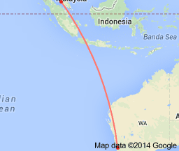
(2) 在我继续我的分析以前, 我要强调那个还在进行着搜寻MH370的位置不是南印度洋,它比较恰当被称为东印度洋(之前我将它称为中印度洋). 如果你有一张地图或一个地球仪在手, 你将会看见哮吼40地带就是指纬度南纬40度周围是真正的南印度洋区域, 而蓝鳍-21的搜寻地区是大约东经100度至东经104度和南纬20度至南纬25度, 所以它应该被称为东印度洋, 不然的话继续称它为南印度洋将会与最早的位于哮吼40地带的搜寻地区产生混淆.
(3) The burst frequency
offset (BFO) data released by Inmarsat is actually identical with those data
used in plotting the graph (see below), which was presented to the victims’ next-of-kin
during one of the meeting with them at about the end of March, that was also the
time the search operation still being conducted in the roaring 40 zone or the
southern Indian Ocean. If you check the 6 points begin from the right side for the
blue line, you will find that the BFO values are identical with those of the
first 6 points in the table above. This proves that the data is only relevant
to the previous southern Indian Ocean region and not the current eastern Indian
Ocean region.
(3) 英麻协公布的“突发频率偏差”数据其实是和测绘那个曲线图(见下)的数据相同的, 那是大约于3月尾和受害者家属的一个会议时发表给他们的, 那也是搜寻行动在哮吼40地带或南印度洋仍然正在进行着的时候. 如果你检测蓝色线从右边起的6个点,
你将会发现突发频率偏差值数和以上的格表里的首6个点是一样的. 这就证明那些数据只是和之前的南印度洋区域相关而不是目前的东印度洋区域.
Reason 14. So, applying the old set of data on the new
search area (eastern Indian Ocean), I think this is a major evidence to debunk
the conclusion that the MH370 is in the Indian Ocean.
理由14. 因此,
采纳旧的数据组用于新的搜寻地区(东印度洋),
我想这是一个主要的证据揭穿MH370在印度洋的结论.
(4) If you are
still not convinced about this contradiction, then, take a look at the graph’s
title, the analysis was based on the speed of aircraft clearly stated as 450
knots. The BFO values in the table was calculated based on the speed of 450
knots, whereas the possible flight paths of the aircraft were calculated based
on the BFO values, then only predict the possible final rough positions, that
is the southern Indian Ocean region, as in the flight path diagram provided by
the investigators (see diagram below), but, nothing relevant to MH370 was found
there, so, the search operation was then moved to the north and northeast, they
had reduced the aircraft’s speed to 325-350 knots, but then the calculation of
BFO should be different, because according to the Doppler effect, the speed of
aircraft affects the BFO values.
(4) 如果你还不能为此矛盾而被说服, 那么,
看一看曲线图的标题, 那个分析是根据飞机的速度而清楚地阐明是450海浬时速. 那些格表里的突发频率偏差数据是根据450海浬时速计算出来的, 而飞机的可能航道是根据突发频率偏差数据算出来的,
然后才推算出可能的最后大概位置, 那就是南印度洋区域, 既如调查员提供的航道图(见下图), 可是,
没什么与MH370有关的东西在那儿被找到, 因此,
搜寻行动后来就向北和东北推移, 他们有将飞机的速度减少到325至350海浬时速, 可是突发频率偏差的计算应该是不同了, 因为根据多普勒效应, 飞机的速度会影响突发频率偏差值数.
Reason 15. Conflicts over contradictions, you may be
more and more disbelieve the MH370 is in the Indian Ocean, since the very
beginning I am 100% believe it is in the Gulf of Thailand.
理由15. 矛盾加上冲突, 你或许越来越不信MH370是在印度洋, 自最初开始我是100巴仙相信它是在泰国湾.
Southern Indian Ocean flight path diagram 南印度洋的航道图
Source of diagrams: Internet Google search
images. 图片来源: 网络谷歌搜寻图像.
30
May 2014 (2014年5月30日)
(5) If you put the
southern Indian Ocean flight path diagram and eastern Indian Ocean flight path
diagram together and analyze, you will find that, when the simulated aircraft’s
speed from 325-344 knots, is increased to 350 knots, 400 knots, till 450 knots,
the distance it could have travelled would also increase to more and more
farther, in the meantime tended to the southwest direction, toward the roaring
40 zone. Previously I have said that such kind of situation is more like the
mechanics mathematic problems, that is, the greater its momentum, the greater
possibility it would travel in straight line and less deflection, later I will
further explain what principles did the investigation groups applied to do such
speculation.
(5) 如果你把南印度洋的航道图和东印度洋的航道图放在一起来分析, 你将会发觉,
当把模拟的飞机速度从325至344海浬时速, 增加到350海浬时速, 400海浬时速, 至450海浬时速, 它可航行的距离也就增加到越来越远, 同时越是偏向西南方向, 朝向哮吼40地带.
之前我已说过这种情形比较像是机械力学数学难题, 那就是,
它的动量越大, 它就越大可能直线飞行而较少偏移, 稍后我将进一步解释调查团是采用什么原则而做出这样的揣测.
Reason 16. You could think and think, what the aircraft
got to do by flying in a more or less straight-line path for a few thousand
kilometres? What also it got to do if it did deflected? When you are thinking
do not incorporate your personal bias opinion, otherwise you will drop into the
fallacy created by yourself, and else introduce a chain of mysteries and
miracles, such as all the people onboard were lost consciousness, the aircraft
must be in programmed auto-piloting, etc.
理由16. 你可想一想, 这飞机那样以差不多直线航道的飞行数千公里是在干嘛? 它若是有偏移又是在干嘛? 当你在想的时候不要注入个人的偏见, 不然你就会掉进自己制造的谬论里, 而且还会引进一连串的迷离与奇迹, 例如机上所有的人已失去知觉, 该飞机必须是处于程控的自动导航等等.
Reason 17. I have mentioned above another point, that
is if 350 knots (650 km/h) is not the optimal fuel-saving speed, then, if
flying with higher speed 450 knots (832 km/h), it could have flown more southward
near to the southern Indian Ocean, but, it was already analyzed that it did not
crash there.
理由17. 我已在上面提起过另一个论点, 就是如果350海浬时速(650公里时速)不是最佳的节省燃油速度, 那么以更高的速度450海浬时速(832公里时速)飞行,
它就可能会飞去更南端靠近南印度洋了, 不过,
已分析过它没在那儿坠毁.
(6) In most pages
of the data released, details were given for every each or several seconds,
mostly repeating and unlikely usable for investigation analysis. But, for the
handshake signals No. 2 to No. 6, “handshake request” and “with response” were clearly
stated at a specific time as “Log-on interrogation”, and “Acknowledge” at about
2 seconds later, other details seemed purposely omitted. This data seemed to
indicate that, for each time of handshake there was only one beeping at one
time, not the continuous pattern such as “beep..beep..beep….” for a period. If
you have a pile of different alarm clocks at a distance in front of you, one of
the clocks beeps only once for less than 1 second, and it repeats every hour
for 6 times, I don’t think you can easily identify which one is beeping.
(6) 在公布数据的大多数页里, 都有给每一秒或数秒的详细资料, 大部分是重复的而且对调查分析不像是有用的. 不过, 第2至第6的握手信号,
“要求握手”和“有回应的”是清楚地阐明于一个特定的时间做为“登录审问”, 和2秒钟后的“告知收到”, 其他资料看似被刻意删除了. 这些数据似乎显示, 每一次握手时只在一个时间内哔一次, 而不是在一段时间内连续的式样如“哔..哔..哔…..”.
如果你有一堆不一样的闹钟在你前面的一段距离, 其中一个闹钟哔了一声少过1秒, 并且每小时重复一次达6次, 我不认为你能轻易的认出是那一个在哔响.
Reason 18. The pings detected in the eastern Indian
Ocean were beeping for several minutes up to more than 2 hours, yet could not
identify the exact direction and location of pinger, and the Australia JACC has
announced to terminate the search by Bluefin-21 after May 28. The Inmarsat
satellite detected the “beep” once in an hour, yet could be used to predict where
the aircraft is, what a miracle, what a mystery.
理由18. 那些在东印度洋探测到的频音是数分钟甚至超过2个小时的哔声, 竟然不能够辨认出频音器的确实方向和位置, 而且澳洲联合代理协调中心已宣布于5月28日后停止蓝鳍-21的搜寻.
英麻协卫星探测到的一个小时内的一次哔声, 却能用来推测飞机在那里, 什么的一个奇迹, 什么的一个迷离.
2
June 2014 (2014年6月2日)
Without relevant
details from the investigators, the following few parts are based on logic reasoning
and scientific hypothesis, when more information is available, I will revise my
analysis accordingly.
没有来自调查员的相关细节, 以下的几个部分是根据逻辑论理和科学设论, 当可得到更多资料时, 我将相应地修改我的分析.
(7) When the
satellite and aircraft’s so-called handshake ping signals data was released on
May 27, many experts claimed that hard to understand it. As I have promised
before, I have led you to approach it from some different angles that we could
understand it, now, let’s go into slightly deeper analysis. First, I will figure
out by guessing how the flight path diagram was derived from the signal data.
You know that the Inmarsat possesses a set of raw signal data, which was
detected by the satellite Inmarsat 3-F1 (which is not released) and transmitted
to the ground station. The investigators applied the Doppler effect, using
sophisticated formula to process the raw data, then produced the Burst
Frequency Offset (BFO) values, as given in the released satellite data and the
relevant handshake data is shown as shown in the table above (Table 1). The BFO
values are then somehow transformed into Burst Timing Offset (BTO) values,
which are then transformed into distances between aircraft (or a pinger) and
the satellite as stated in the satellite data report released on May 27.
(7) 当卫星和飞机的所谓握手频音信号于5月27日公布时, 很多专家声称很难理解它. 即如我之前所承诺, 我已带领你从某些不同的角度来接触它, 现在,
让我们进入稍微较深的分析. 首先,
我将以猜测来揣摩出航道图是如何源自于信号数据的. 你知道英麻协拥有一组原生信号数据, 那是由英麻协3-F1卫星探测到的(它没被公布)以及传送到地面卫星接收站. 调查员们应用多普勒效应, 用复杂的方程式来处理该原生数据, 然后产生突发频率偏差(BFO)值数, 就如公布的卫星数据里所给的和显示于上面格表里的相关握手数据(格表1). 那些BFO值数然后不知如何又转换成突发时定偏差(BTO)值数, 那又转换成飞机(或一个频音器)和卫星之间的距离即如在5月27日公布的数据报告中所阐明的.
(8) Now, let’s assume
the handshake data No. 6 was used to calculate the almost final distance of the
aircraft pinger from the satellite, which was recorded at 8:11 am of March 8,
the earliest announced time of handshake signal. The data of handshake No.7 was
said to be uncertain and still under investigation, that was recorded at 8:19
am, these are the times the aircraft’s fuel was said used up and descended into
the sea within 8 minutes, so the difference in distance should be only in order
of tens of kilometres, that means could ignore the handshake No.7 data, which
is also not appear in the graph (which I will further elaborate in later
analysis), thus they might have used the handshake No. 6 data to determine the
aircraft’s final distance.
(8) 现在, 让我们假设第6个握手数据是被用来算出从卫星到飞机频音器的最后大概位置, 那是于3月8日凌晨8时11分所记录的,
是最早被宣布的握手信号时间. 第7个握手数据据说是不确定的和仍在调查中, 那是在凌晨8时19分所记录的,
这些时间就是飞机的燃油被说耗尽和8分钟内降低进入海洋的, 因此其距离的差别应该是以十里倍数来算, 那就意味可以忽略第7个握手数据,
那也是没出现在曲线图的(我将在以后的分析再做细说), 因此他们可能是用第6个握手数据来确定飞机的最后距离.
(9) The
investigators could then use the distance obtained as a fixed value between the
satellite and the aircraft, the distance is about 5,000 plus km from the
satellite’s relative ground position, which is at about 64.5oE and about
on the equator, then used it as the central point to draw a circle with a
radius of about 5,000 plus km, but it cannot stand alone to determine the
location of the aircraft. So, the satellite data investigators have to
corroborate with the Malaysian military radar data and aircraft engine
performance data. Upon corroborative calculations, the investigators concluded
with a flight path arc across the southern Indian Ocean to the eastern Indian
Ocean regions, drawn as a light blue curved line in the southern Indian Ocean
flight path diagram, which is embedded in the longitudes of about 90oE
to 105oE and latitudes 20oS to 40oS.
(9) 调查员们可能之后就用所得的距离做为卫星与飞机的一个固定值数, 该距离是大约在东经64.5度和大约在赤道上的卫星与相对地面的位置大约5,000多公里, 然后用它做为中心点来画一个半径约5,000多公里的圆圈, 但它不能独自的去确定飞机的位置. 因此,
卫星数据调查员们必须和马来西亚军方雷达数据以及飞机引擎性能数据核对. 经过核对计算, 调查员们做出的结论是以一个跨越南印度洋到东印度洋区域的航道弧线, 就如南印度洋航道图里所画的浅蓝色弧形线, 那是涵盖于经线东经90度到东经105度和纬线南纬20度到南纬40度之内.
Southern Indian Ocean flight
path diagram Eastern Indian Ocean flight path diagram
Source of diagrams: Internet Google search images. 图片来源: 网络谷歌搜寻图像.
(10) Corroboration
means a few groups of people bring with their own data come together, discuss
the discrepancy between data and controversial measurements, examine any
differences, decide ways to adjust certain data and factors to modify certain values,
these practice always could be allowable by giving acceptable reasons such as
errors due to standard calibration and accuracy of equipment, etc., but such
kind of data handling if not properly done it could become data manipulation.
(10) 核对的意思是几组人带他们自己的数据聚在一起, 讨论数据的相差和具争论性的测量, 检查任何差别, 决定途径以调整某些数据和因素以修改某些值数, 这些做法往往是许可的只要给以能接受的理由例如由标准校正和仪器的准确性, 等等,
不过这样处理数据如果没有恰当的做可能变成操纵数据.
(11) The
investigation group’s earliest conclusion before end of March was that, the
aircraft ended in the southern Indian Ocean, because the three groups of data
seemed to strongly agree with each other, namely the distance derived from
satellite data, fuel and speed data of aircraft, and the time unidentified
aircraft disappeared from the military radar. However, nothing relevant to
MH370 was found in the southern Indian Ocean region.
(11) 调查团于3月尾之前的最早结论是, 飞机是在南印度洋终结, 因为三组数据似乎很坚定的相互同意, 既是源自于卫星数据的距离, 飞机的燃油和速度数据, 以及不明身份飞机从军用雷达上消失的时间. 无论如何,
没有任何与MH370有关的东西在南印度洋找到.
(12) Being as the
main lead in the investigation, the satellite data analysis result remains
unchanged, because it was obtained by high technology instrument and considered
as the most reliable evidence by the investigators, official authorities,
experts, the world media and public. So, the other two groups of data should
then be more seriously corroborated.
(12) 做为调查的主导, 卫星数据的分析结果保持不变, 因为它是由高科技仪器所获得而且被调查员, 官方当局, 专家,
世界媒体和公众考虑为最可靠的证据. 因此,
其他的两组数据就应该更严谨地核对了.
Reason 19. The outcomes of the more stringent corroboration are: (a) the fuel consumption
was made to be used up for shorter distance that the aircraft could travel, while
the distance of aircraft from satellite and the time it ended in the Indian
Ocean remain unchanged, so the ended location was thus pushed from southern
Indian Ocean region to the eastern Indian Ocean region, it seemed to be logic
by doing so, but it is scientifically invalid, because the speed of aircraft
have to be reduced from 450 knots to 325-350 knots, and they may argue that the
aircraft was at lower altitude, I have mentioned this point in the Reason 7, I hope you will now understand
why the aircraft travelled with slower speed but ended in shorter distance from
Andaman Sea.
理由19. 更严格核对的结局是: (a) 燃油消耗被弄成为该飞机可航行的较短距离而耗尽, 而飞机在印度洋终结的时间和飞机与卫星的距离维持不变, 因此终结的位置就从南印度洋推向东印度洋区域, 这样做看起来好像合逻辑, 但它是科学上是不成立的, 因为飞机的速度就必须从450海浬减到325至350海浬,
他们可能会辩驳该飞机是在较低的海拔, 我有在理由7提及过这一点, 我希望你现在明白为什么飞机从安达曼海以较慢的速度航行却在较短的距离终结.
Reason 20. (b) The consequence of changing the search position by reducing the
aircraft’s speed is the timing problem, there are signs showing push back the
times of those events prior to the detection by Inmarsat satellite, these times
are therefore different before and after the release of preliminary report
(i.e. after corroboration), these are summarized in the following table. I
don’t believe you can trust the corroboration and Inmarsat’s data analysis that
give rise to time conflicts.
理由20. (b) 以减低飞机的速度来改变搜寻位置的一个后果是时定问题, 有迹象显示在英麻协卫星探测到之前那些事件的时间被推前, 这些时间就因此在公布初步报告之前和之后(既核对之后)有所不同了, 它们即如以下的格表所概述. 我不相信你可以信赖那些产生时间冲突的核对和英麻协的数据分析.
Table 2.
格表2.
Events
事件
|
Time (before)*1
时间(之前)*1
|
Time (after)*2
时间(之后)*2
|
1. Last civil radar point
at IGARI
1. 在伊嘎里的最后民用雷达点
|
1:30 am
(turn-back)
凌晨1时30分 (折返)
|
1:22 am
凌晨1时22分
|
2. Detection of
unidentified aircraft near Perak Island
2. 靠近霹雳岛探测到不明身份飞机
|
2:15 am
凌晨2时15分
|
2:01:49 am
凌晨1时49分
|
3. Aircraft disappeared
from military radar
3. 飞机从军用雷达消失
|
2:40 am
凌晨2时40分
|
2:22:00 am
凌晨2时22分
|
4. First handshake ping
signal detected by Inmarsat satellite
4. 英麻协卫星探测到第一个握手频音信号
|
2:27 am
凌晨2时27分
|
2:27:04 am
凌晨2时27分零4秒
|
5. Second last signal
detected (the 6th handshake signal)
5. 探测到最后第2个信号(第6个握手信号) |
8:11 am
早上8时11分
|
8:11:00 am
早上8时11分
|
6. Last signal detected
6. 探测到最后一个信号
|
8:19 am
早上8时19分
|
8:19:29 am
早上8时19分29秒
|
*1 Times before the preliminary report was
released, some of these were officially announced and reported by the media.
The time 8:11 am was given since the mid of March, the other 2 handshake signal
times have been “mentioned” only after mid of March and officially released in
the Inmarsat satellite data on May 27.
*1 初步报告公布之前的时间, 其中一些是官方公布和媒体所报道的. 凌晨8时11分是自3月中就给了,
另外2个握手信号的时间是在3月中以后有被“提及”和在5月27日官方公布于英麻协卫星数据.
*2 Times given in the eastern Indian Ocean flight
path diagram released together with the preliminary report on May 1.
*2 在5月1日初步报告一起公布的东印度洋航道图里所给的时间.
5 June 2014 (2014年6月5日)
(13) Well, let’s see how the investigators analyze the first handshake signal data at 2:27 am as given in the eastern Indian Ocean flight path diagram. The so-called first handshake is actually consisting of three data points between 2:23 am and 2:29 am, as shown in the graph of burst frequency offset against time, which shows a consistent drop in the BFO, with the first point having BFO about 272 Hz, second point BFO about 175 Hz and the third point BFO about 142 Hz (estimation from graph). However, in the satellite data report there is a range of fluctuation of BFO values during the time between 2:25 am to 2:28 am; among these series of data, the 3 graph points closely correspond to 3 selected satellite data are: 2:25:34 am and 273 Hz, 2:27:08 am and 172 Hz, 2:28:14 am and 143 Hz. There are only 3 data points selected (although there is some minor discrepancy in time), which should be having some significant meaning to the investigators.
(13) 好吧, 让我们看看调查员如何分析在东印度洋航道图所给的于凌晨2时27分的第一个握手信号数据. 那所谓的第一个握手其实是由凌晨2时23分至凌晨2时29分之间的3个数据点组成, 即如突发频率偏差对时间的曲线图里所显示的, 那就显示突发频率偏差的持续下降, 以第一点的突发频率偏差大约272赫兹, 第二点的突发频率偏差大约175赫兹和第三点的突发频率偏差大约142赫兹(从曲线图上估计). 无论如何,
在卫星数据报告里于凌晨2时25分至凌晨2时28分的一段时间里有一个起落不定范围的突发频率偏差值数; 在这数据系列中, 那3个曲线点与3个被选取的近相应卫星数据是: 凌晨2时25分34秒和273赫兹,
凌晨2时27分零8秒和172赫兹, 凌晨2时28分14秒和143 赫兹. 那只有3个被选的数据点(虽然有一些时间上的微差), 它应该是对调查员具有某些意义的吧.
Reason 21. If you convert the first handshake signals into beep sounds, it would
be like “beep.beep.beep”, it is hard to believe that other handshake signals
only beep once for each time, yet could be so definite confidence for the
investigators to believe that they were from MH370.
理由21. 如果你把第一个握手信号转换成咇声, 它就会像是“咇.咇.咇”, 很难相信其它握手信号每次只咇一声, 却能让调查员那么有自信地相信它们是来自MH370.
(14) For the first
handshake signals, the burst timing offset (BTO) values are even more seriously
fluctuating, for example the BTO value for the first graph point (51700
microseconds) is so large within this three-point data set and as compared with
other data. What method and formulas the investigators used to derive these
values from the BFO values was not explained in the satellite data report, you
must have some doubts.
(14) 至于那些第一个握手信号, 那些突发时定偏差值数更是起落不定, 例如第一个曲线点的突发时定偏差值数(51700微秒)是那么大于这三点组中的数据以及和其他数据比较. 调查员是用什么方法和方程式自突发时定偏差值数渊生这些值数并没有在卫星数据报告中给于解释, 你一定会有某些疑惑.
Reason 22. If some of the data points were given different treatment and the
investigators are skeptical to explain, there is a possibility of bias data
handling, the analysis would be therefore unreliable.
理由22. 如果其中的某些数据点是被给以不同的处理而调查员则顾忌于解释, 那就有可能是有偏见地处理数据, 该分析就可能因而不可靠了.
Reason 23. It is indicated for the three-point set in the graph, “possible turn”
is clearly labeled for the first point, may be this is what the investigators
suggesting that the aircraft was initially in the northwest direction at the
Andaman Sea, and then turn toward southwest and south. However, the
investigators did not explain why BFO and BTO values decreased so drastically
within 3 minutes.
理由23. 在曲线图里的三点组合里显示, “可能转弯”在第一点明显标明, 或许这就是调查员所建议的飞机起初在安达曼海是往西北方向, 而后转往向西南方和南方. 然而, 调查员并没有解释突发频率偏差和突发时定偏差值数为什么在3分钟内会有那么巨大的降低.
(15) If the BFO value of the data point at
about 2:25 am indicates a turn, then it would be a conflict in time with the
time the aircraft disappeared from military radar at 2:40 am, because the
aircraft was on its way to northwest of Penang, not turning to the south yet, as
recorded by the radar.
(15) 如果突发频率偏差值数在大约凌晨2时25分的数据点显示为一个转弯, 那么它将是于凌晨2时40分飞机从军用雷达上消失的时间有时间上的冲突, 因为飞机是从槟城往西北方向的途中, 而还未转弯向南呢, 即如雷达所记录.
Reason 24. Since the satellite data was the main lead in the investigation, its
times for the handshake signals are all remain unchanged. So, you may suspect,
to accommodate the Inmarsat’s time data during corroboration, the investigators
might have adjusted the time when unidentified aircraft disappeared from radar,
from 2:40 am changed to 2:22 am, so that it become happened before the first
handshake time 2:25 am.
理由24. 由于卫星数据是调查的主导, 其握手信号的时间全都保持不变. 因此, 你可能怀疑,
核对时为了配合英麻协的时间数据, 调查员可能有做过调整不明身份飞机从雷达上消失的时间, 从凌晨2时40分改成凌晨2时22分, 因此它变成凌晨2时25分的第一次握手时间之前发生了.
Reason 25. There must be a different opinion amongst the investigators, who firmly
think that, up to the point the aircraft disappeared from the military radar,
there was deliberate action in maneuvering the aircraft across Malay Peninsula,
that means during the time of lost contact at 1:21 am to 2:22 am. Otherwise,
the idea of the deliberation would be a conflict with the programmed
auto-piloting, because auto-piloting is required to support the speculated Indian
Ocean flight paths, without auto-piloting, you have to think of another reason
how the aircraft could fly to Indian Ocean.
理由25. 调查员之间一定是有一个不同的看法, 他们坚定地认为, 直到飞机从军用雷达消失那个地点之前, 有蓄意行为在操控该飞机横越马来半岛, 那是指于凌晨1时21分失联到凌晨2时22分的那段时间. 不然的话,
蓄意那个想法将和程控自动导航有冲突, 因为自动导航是需要来做为支配揣测中印度洋航道的, 没有自动导航, 你就得想出另一个理由该飞机是如何可能飞到印度洋.
11 June 2014 (2014年6月11日)
(16)
Next, let’s look into the data of handshake signals No. 2 to No. 5. These 4
signals were detected hourly and exact to minutes at 3:41 am, 4:41 am, 5:41 am
and 6:41 am, only differ in their seconds’ time. How had investigators
interpreted these data? Unlikely there was someone onboard so simply pressing
button to send the signals with accurate timing, if there was someone
consciously sending signals, he could have been doing so every some minutes
rather than hourly. But, if the signals were sent by an automatic device, you
have to assume all people onboard were unconscious or under critical control.
(16) 接下来, 让我们探讨第2个至第5个握手信号的数据. 这4个信号是每个小时探测到的而准确至分钟于凌晨3时41分, 凌晨4时41分, 凌晨5时41分和凌晨6时41分, 只是它们的秒数时间不同. 调查员怎么解读这些数据呢? 不像是机上有某人轻易地按钮来准时发送那些信号, 如果有某人有意识地发送信号, 他应该可能每数分钟而不是每小时做吧. 不过, 如果那些信号是以一个自动装置来发送, 你就须假定机上所有人已失去知觉或是在危急控制下.
Reason 26. If the investigators try to
explain why the first handshake signals and the last two handshake signals were
not in the hourly interval, signal No. 6 was after an interval of 1 hour 30
minutes, whereas signal No. 7 was 8 minutes later, they will be stuck in
speculation.
理由26. 如果调查员尝试解释为何第一个握手信号和最后两个握手信号不是每小时间隔, 第6个信号是1小时30分钟间隔之后, 而第7个信号是8分钟之后, 他们将会陷困于揣测中.
Reason 27. The 4 burst frequency offset
values increase consistently, almost a linear line as shown in the graph, but
the burst timing offset values increase in a slightly exponential manner, that
suggests a non-linear formula was applied in the data processing, in other
words different factor magnitudes were incorporated in calculation of times and
then distances, however, the investigators are not yet willing to disclose the
method and formula they used, so, people in the world are speculating on the
investigators’ speculation.
理由27. 那4个突发频率偏差的值数一致地增加, 几乎是如曲线图所显示的直线性, 不过突发时定偏差的值数增加有些指数型的方式, 那就建议一个非直线性方程式在数据处理中被采用, 换句话就是不同的因数量被并入于时间然后是距离的计算, 然而, 调查员仍旧不愿公开他们所用的方法和方程式, 所以, 世人只好在揣测调查员的揣测了.
(17) The
frequencies of the handshake signals are very crucial information but not
mentioned in the satellite data released on May 27. For the signals be able to
transmit through long-distance atmosphere, its frequency must be high enough and
amplitude or intensity strong enough to reach the satellite about 35,780 km
away in the airless space. The radio frequency examples for electromagnetic
waves are in the range of 88-108 MHz for FM channels, and 540-1,600 kHz for AM
channels. The handshake signal frequency between the satellite Inmarsat 3-F1
and aircraft is possibly much higher, whereas the burst frequency offsets given
by Inmarsat are only within the range of 100-300 Hz.
(17) 那些握手信号的频率是很决定性的质料但是没在5月27日公布的卫星数据中提及. 欲使信号得以传导穿过长距离大气层, 它的频率必须够高以及振幅或强度够强才能到达在35,780公里外无空气的太空中的卫星. 电磁波的无线频率例项是FM波道在88百万赫兹(兆赫兹)至108百万赫兹(兆赫兹)范围内, AM波道在540千赫兹至1,600千赫兹范围内. 卫星英麻协3-F1和飞机之间握手信号的频率可能是更高的, 而英麻协所给的突发频率偏差只是在100赫兹至300赫兹范围内.
16 June 2014 (2014年6月16日)
Reason 28. You could find from internet
that mobile phone frequency range is 450-2700 MHz. Unlikely the investigators
can know exactly what frequencies were the so-called handshake ping signals
sent by MH370, it is said so because the Inmarsat do not have such data to
announce, the investigation only presumed frequencies from other aircrafts. For
discussion, let’s also presume 1110 MHz (i.e. 1,110,000,000 Hz) as a source
frequency within the mobile phone frequency was used, if the aircraft had moved
toward equator at 3:41 am, it should be relatively “approaching” (almost in
parallel manner) the satellite, therefore frequency detected by the satellite
should be higher, according to the burst frequency offset of 111 Hz, the
frequency detected would be 1,110,000,111 Hz, to be able to identify such
frequency as meaningful signal and distinguishable from other signals, the instrumental
background noise level is unlikely more than 100 Hz or even lower, the
detection must be done by some sort of very sensitive equipment, the
transmission and detection must be extremely efficient, you may doubt what kind
of equipment and technique were applied.
理由28. 你可从网络找到移动手机的频率范围是450百万赫兹至2700百万赫兹. 调查员不像可以准确地知道那些所谓由MH370发送的握手频音信号的频率, 之所以这么说是因为英麻协没有这样的数据公布, 该调查只不过是从其他飞机所假定的频率. 为了讨论, 让我们也假定所用的来源频率是1110百万赫兹(即1,110,000,000赫兹)为移动手机的频率范围内, 若飞机于凌晨3时41分曾向赤道移动, 它应当是相对地(几乎是平行的)趋近卫星, 因此卫星探测到的频率应该是较高的, 根据突发频率偏差的111赫兹, 探测到的频率应该是1,110,000,111赫兹, 要能够辨认这样的频率是有意义的信号以及可以和其他信号辨别, 该仪器的背景噪声程度不像会超过100赫兹或更低的,该探测必定是由某些很敏感的仪器所办到, 该发送和探测必定是极度的有效, 你或许会疑惑其所采用的是那类仪器和技术.
(18) On June 17, the Inmarsat’s scientist told the BBC’s
Horizon programme that they had calculated the aircraft’s most likely flight path
and a “hotspot” in the southern Indian Ocean, Chris Ashton at Inmarsat told
Horizon: “It was by no means an unrealistic location but it was further to the
northeast than our area of highest probability”. The statement is a very typical
ambiguous kind of speaking that may lead to confusion and misinterpreted by the
media, experts and public. The “current” deep-sea search area is that coordinated
by Australia’s JACC but ended in May till now, it was based on the ping signals
detected by Bluefin-21, which was claimed to be from the black box of MH370, but
now are believed to be bogus signals. That area as I mentioned earlier should
be named the eastern Indian Ocean, otherwise it will confuse your understanding. Now the Inmarsat claimed it to be unrealistic location,
does it mean the highest probability area given in the flight path diagram
released together with the preliminary report is invalid, are they disagreeing the
points they have previously agreed with?
(18) 于6 月17日, 英麻协的科学家告诉英国广播公司的“视野”节目他们所计算的飞机最可能的航道和一个在南印度洋的“热点”, 克里斯阿士顿告诉“视野”: “那并不是一个实际的位置不过是我们的最高可能性地区的更远的东北部”. 这个陈述是一种很典型的含糊之类的说法, 那可能会导向混淆和使到媒体, 专家和大众曲解. 那个“现时”深海搜寻区域是由澳洲的联合代理协调中心所协调但已于5月暂停至今, 那是根据蓝鳍-21探测到的频音信号, 被声称是来自MH370的黑箱, 不过现在被相信是伪造的信号. 那个地区我早前提起应该称为东印度洋, 不然会混淆你的理解. 现在英麻协声称那是不切实的位置, 那可意味和初步报告一起公布的航道图里所给的最高可能性地区是无效的, 他们是不同意他们之前所同意的论点吗?
Reason 29. Due to statement ambiguity, some people and media interpreted that
the “hotspot” suggested by Inmarsat should be further to the northeast from the
current search area at eastern Indian Ocean (about 100oE to 104oE
and 20oS to 25oS, i.e.
northwest of Perth), it would mean further nearer to Indonesia, but it is out
of sense in terms of time-distance-fuel logics. If what he meant the MH370
should be further southwest, towards the roaring 40 zone, on the west or
southwest of Perth, I think they are trapping themselves back to their old
fallacy.
理由29. 由于含糊不清的陈述, 某些人和媒体解读那些由英麻协建议的“热点”应该远于现时东印度洋(大约东经100度至东经104度和南纬20度至南纬25度)搜寻地区的东北处, 那就意味更接近印尼, 但那是出乎于时间-距离-燃油逻辑之外的想法. 如果他的意思是MH370应该是更西南部, 朝向哮吼40地带, 在柏斯西部或西南部, 我想他们是在把自己陷困回自己的旧谬论中.
Source of diagrams: Internet Google search images. 图片来源: 网络谷歌搜寻图像.
19 June 2014 (2014年6月19日)
(19) The
computed BFO values of satellite data were claimed to be very close to the
predicted values, as shown by grey colour plot in the graph of BFO versus UTC time,
as claimed by Inmarsat, that was based on the signals recorded for 6 aircrafts
on the same day the MH370 went missing, these have been used as strong proof to
support their conclusion that the aircraft had flown to the Indian Ocean.
(19) 那些卫星数据计算出来的突发频率偏差值数被称为和推测的值数非常接近, 即如突发频率偏差对世界时间的曲线图所显示的灰色绘图, 即如英麻协所称, 那是根据MH370失踪的同一天的6架飞机所记录到的信号, 它们被做为有力的证据以支配他们的结论既是飞机曾有飞去印度洋.
Source of diagrams: Internet Google search images. 图片来源: 网络谷歌搜寻图像.
Reason 30. However, among the 6 aircrafts,
none was taking the exact flight path as predicted for the MH370 flying towards
southern Indian Ocean, the investigation also did not arrange a physical trial
experiment for actual trailing along the speculated flight path. Thus, it is very
curious how the investigators worked out the plots and BFO values for prediction
and measurement for MH370, yet could be so closely matching each other, if the
measured data could match those of any of the 6 true aircrafts, then the presumed
MH370 should follow the flight paths of the true aircrafts but not along the
southern Indian Ocean flight path that does not exist. How the signals of the 6
aircrafts were selected, remained the secrets of Inmarsat, certainly the
investigators themselves know whether precision and accuracy have been
exaggerated.
理由30. 然而, 在那6架飞机当中, 没有一架是取道如推测中MH370飞向南印度洋的确切航道, 该调查也没安排一个实体尝试性的实验做确实地跟循揣测的航道. 因此, 非常好奇调查员是如何做出图绘与突发频率偏差值数予推测和MH370的测量, 却能如是彼此接近地相配, 如果测量到的数据可以配对到那6架真实的飞机, 那么假设中的MH370应该遵循那些真实的飞机航道而不是跟着一个不存在的南印度洋航道. 那6架飞机的信号是如何被选取的, 依然是英麻协的秘密, 当然调查员他们自己是知道精准性和准确性有否被夸大的.
Reason 31. If the MH370 had travelled to
southern Indian Ocean, when it moved toward the equator, it should be moving relatively
closer (in parallel) to the satellite which was located in the space across and
above the equator, so the frequency measured should be larger than the
frequency emitted (i.e. BFO are positive values), only after passing the
equator, when it moved further to the south at about 3:41 am, that means when it
moved away from the satellite, then the measured frequency should be smaller
(i.e. BFO are negative values), but, why the BFO values are all positive? The
Inmarsat does not have the actual emitted frequency, they should clarify these
doubts.
理由31. 如果MH370有航行往南印度洋, 当它向赤道移动时, 它应该是移动相对地趋近(平行地)卫星, 那是位于太空中横越赤道和在其上的, 因此所测量到的频率应该是大于所放射的频率(既是突发频率偏差是正数), 只有经过赤道之后, 当它于凌晨3时41分进一步向南移动时, 意思是它离卫星更远时, 那么测量到的频率应该比较小(既是突发频率偏差是负数), 但是, 为什么突发频率偏差全部都是正数? 英麻协根本就没有真正的发射频率, 他们应该澄清这些疑点.
20 June 2014 (2014年6月20日)
Reason 32. When the MH370 was (speculated) travelling
with a speed of about 650 km/h (350 knots) across the equator on the Indian
Ocean, the satellite Inmarsat 3-F1 at about 40,000 km away was moving across
the equator with a speed of about 180 km/h, how the hourly single ping can be
so unique that it could be deduced as emitted from MH370? Under what condition,
what kind of aircraft’s pinger (signal emitter) could be triggered to send
signal hourly? The investigators have to explain many assumptions and doubts
arose from their speculation, it is speculation, because there yet to be any
concrete evidence to support their hypothesis.
理由32. 当MH370(被揣测)以速度大约650公里时速(350海浬时速)航行横越印度洋上的赤道时, 在大约40,000公里以外的卫星英麻协3-F1正以速度约180公里时速移动横越赤道,如何每小时的单独频音可以那么独特以致它能够被推理是从MH370发射出的呢? 在什么情况下, 哪一种飞机频音器(信号发射器)能够被启动来每小时发送信号呢? 调查员们必须解释由他们的设想和揣测所产生的很多疑点, 那是揣测, 因为还没有任何强固的证据支持他们的设论.
24 June 2014 (2014年6月24日)
(20) In
order to testify the validity of the satellite data, one of the ways is to
determine the mechanism of handshakes between the satellite-ground station and
aircraft, which includes: whether it was done automatically or manually, and which
side are the initiator and responder. There were 4 possible combinations of
handshake mechanisms between the satellite’s ground station and the aircraft,
i.e. automatic-automatic, automatic-manual, manual-manual, or manual-automatic.
If the Inmarsat’s satellite or its ground station has a mechanism to do handshake
automatically, it’s staff might not have discovered about the handshake actions
immediately, but realized only some times after the contact, or playback after
days. If the ground station did the handshake manually, the staff must be the
kind of extremely alert person and realized such handshakes at immediate time if
the MH370 had initiated the contact. For the aircraft side, it is also
controversial if it was manual, you have to presume at least one person onboard
was still conscious and able to do handshake. So, you may infer based on some
circumstances in relation to the investigators’ speculation, satellite-manual
and aircraft-automatic interaction should be the most relevant to the handshake
contact.
(20) 要验证卫星数据的有效性, 其中一个途径就是要确定卫星-地面接收站和飞机的握手机制, 包括: 它是自动地还是手动的来办到, 以及那一方是发起者和回应者. 卫星之地面接收站和飞机之间的握手机制有4个可能组合, 既是自动-自动, 自动-手动, 手动-手动, 或手动-自动. 如果英麻协的卫星或其地面接收站有一个机制自动性地做握手, 它的员工可能不会即刻就发现握手行动, 而是接触后的一些时间, 或数天后重播. 如果地面接收站是做了手动的握手, 该员工必定是极度警觉之类的人而如果MH370有发起接触则能即刻就发觉那样的握手. 至于飞机那一边, 如果是手动的也具争论性, 你必须假设飞机上至少有一人是清醒而且有能力做握手. 因此, 你或许就会根据与调查员的揣测有关的某些形势作出推敲, 卫星-手动和飞机-自动的接触应该是最为相关的握手联络吧.
(21) Since
the MH370 aircraft was thought had flown into the Indian Ocean, till now, the investigators
and the most and most people think that, the aircraft was on auto-piloting and
all people onboard were unconscious, somehow the aircraft was emitting one
signal hourly, detected by the satellite Inmarsat 3-F1, transmitted back to
ground station, which then manually responded to the signal by sending back a
signal, that is what people understand as the handshake. But, there is a major
and serious controversy, no more than a few people in this world could have self-realized
about it, unless you have learned about the concepts such as alike to equilibrium
and mechanism elementary steps in chemistry, and be very meticulous.
(21) 自从MH370飞机被联想有飞入印度洋以来, 至今, 调查员和绝绝大多数的人认为, 该飞机是处于自动导航而机上的全部人都无意识了, 不知如何该飞机每一个小时发送一个信号, 被卫星英麻协3-F1探测到, 转播回地面接收站, 它然后手动地发送回应信号, 那是人们所理解的什么是握手. 但是, 有一个重要而严重的争议, 世上没几个人会觉悟到, 除非你有学过一些概念如似化学科里的均衡论和机制的基本步骤, 以及非常小心翼翼.
Reason 33. During the period of the so-called
handshake contact, which side actually initiated the handshakes? The satellite-ground
station or an aircraft? You could refer to the satellite data, for the
handshake signals No.2 to No. 6, stated as “Handshake Request, with response”,
for example, at 19:41:00 UTC (3:41:00 am MYT), the satellite-ground station
initiated “Log-on interrogation” using P-channel TX, then at 19:41:02 UTC
(3:41:02 am MYT), it received “Log-on/Log-off Acknowledge”. Do you realize the strange
sequence now? It means, the ground station sent out signal to/through satellite
(unlikely the satellite by itself could decide when to send out signals), 2
seconds later it received acknowledgment signal, which was thought from the
MH370, the signal frequency was later measured, which was at later days used to
compute the BFO value (by applying Doppler’s effect), BTO was then calculated
and distance from satellite was also calculated. Do you see the crack point? It
was the satellite first “poked” the aircraft, then only the aircraft “poked”
back, something like the previous Facebook “poke function”, isn’t? When it did
not poke for as long as 1 hour, there was no poke back too. Can you guess why?
理由33. 正当所谓的握手联系的期间, 那一方实际上发起该握手? 是卫星-地面接收站还是一架飞机? 你可以参考那些卫星数据, 对于第2个至第6个握手信号, 如所阐明“要求握手, 有回应”, 例如, 于世界时间19时41分零秒(马来西亚时间凌晨3时41 分零秒), 卫星-地面接收站用P-频道TX启动“登录开查询”, 然后于世界时间19时41分零2秒(马来西亚时间凌晨3时41 分02秒), 它接收到“登录/登出告知). 你现在察觉那奇怪的次序了吗? 它的意思就是, 地面接收站发送出信号给或通过卫星(不像是卫星自己本身会决定何时送出信号吧), 2秒钟过后它就收到告知信号, 被认为是来自MH370的, 信号的频率后来被测量了, 它在后来的几天用来计算出突发频率偏差的值数(采用多普勒效应), 然后计算出突发时间偏差以及也计算出与卫星的距离. 你看到它的破绽了吗? 那是卫星先“戳”该飞机, 然后飞机才“戳”回, 就好像之前面书的“戳作用”, 不是吗? 当它没有戳长达1小时, 也就没有被回戳了. 你能猜到为什么吗?
Reason 34. The satellite-ground station or
the aircraft being the first to start the contact every hour has a crucial
implication. If the aircraft was preset to send out signal, then it is acceptable
the aircraft could be in some unforeseen situations. If it was the
satellite-ground station that initiated each of the handshakes No. 2 to No. 6, there
will be many doubts arise: Why the satellite-ground station in the first place
send signal to the aircraft? At those times, there could be tens to hundreds of
aircrafts in the air in the IOR zone where the satellite Inmarsat 3-F1 situated
(which has coverage over Australia, Asia, Africa and Europe), how precisely
MH370 is the only possible one that responded the signals?
理由34. 是卫星-地面接收站还是飞机带头每个小时开始联络有很重要的含义. 如果飞机是被预设来发送信号, 那么是可接受的它可能处于某些意料之外的状况. 如果是卫星-地面接收站起动第2至第6的每一个握手, 就会有很多疑点出现了: 首当其冲为什么卫星-地面接收站发送信号给飞机? 在那些时候, 在卫星英麻协所在的印度洋地带那儿应该是有数十至数百架飞机在空中吧(那儿是覆盖于澳洲, 亚洲, 非洲和欧洲), 有多准确MH370是唯一的可能回应那些信号呢?
27 June 2014 (2014年6月27日)
Reason 35. The satellite data released on
May 27 clearly shows that, satellite-ground station was the initiator for the
handshakes No. 2 to No. 6, it is unlikely a typo error or data row mess-up, simple
logic explanation to support this argument are, firstly, if the aircraft was
the initiator to send out the signal, the ground station would not be able to
know how much time taken by the signal before reaching them, because there was
no continuous to-and-fro contact, but only one signal in one hour, similarly
they would not know how much time their return signal would take to reach the
aircraft, they only could know the lag time between the reception of “aircraft’s
signal” and their return signal is 2 seconds, in other words, it should be the ground
station system’s responding time; secondly, if the ground station acknowledged
the aircraft’s signal manually, the operator must have been very strictly standby
in front of the monitor or keyboard, every second in alert, just like playing
computer game, every moment ready to strike the return key, do you think that
is logic?
理由 35. 于5月27日公布的卫星数据清楚地显示, 卫星-地面站是第2至第6握手信号的起发者, 那不像是排印错误或数据排列搞乱, 简单逻辑的解释以支持这个论点就是, 第一, 如果飞机是起发者发出信号, 地面站是无能力知道该信号到达飞机之前究竟用了多少时间, 因为没有持续性一来一往的联系, 而只是一小时一个信号, 同样的他们不会知道他们的回应信号用了多少时间才到达飞机, 他们只可能知道接收到飞机的信号和他们的回应信号之间的迟延时间是2秒钟, 换句话, 那应该是地面站系统的反应时间吧; 第二, 如果地面站是以手动来答知飞机的信号, 那个操作员一定是在屏幕或键盘前很严格地等待着, 每一秒钟都警觉, 就像是在玩电脑游戏, 时时刻刻都在准备着打击返回键, 你认为那样逻辑吗?
Reason 36. Thirdly, you may reconsider the
other mechanism, that is, the aircraft was automatically sending out signal,
and the ground station also automatically returned signal. Then, the ground
station staff might not realize when their system has received those signals. And,
you have to answer the question I asked previously, what kind of unique equipment
that emitting one signal and then stopped for exactly 1 hour, if the ground
station was so sensitive such that every time it has detected a signal it
automatically acknowledged by returning a signal, what purpose is such a responsive
system designed for? My main point is, the presumed aircraft was not the
initiator sending the signal first.
理由 36. 第三, 你可能重新考虑其它机制, 就是, 飞机自动发送出信号, 而地面站也是自动回应信号. 那么, 地面站的职员可能就不会察觉是何时他们的系统有收到那些信号. 而且, 你就须回答之前我问过的问题, 是什么类型的独特仪器发射了一个信号然后停了准准1个小时, 如果地面站是如此敏感到每次它收到一个信号它就自动回应一个信号来答知, 如此回应型的系统是为什么目的而设计的呢? 我的要点是, 假设中的飞机不是起发者先发送信号.
(22) Assume
one of the ground stations (include one in Australia) for the satellite
Inmarsat 3-F1 was involving in the handshake contact, the distance from it to
the satellite is about 40,000 km, and the distance for the aircraft in the
Indian Ocean to the satellite is also about 40,000 km, total distance is 80,000
km. The speed of an electromagnetic radio frequency is same as light,
travelling in vacuum at 300,000 km/s, but slower in the atmosphere layer. So, a
signal frequency penetrating through atmosphere and travel in the space for
one-way 80,000 km may need 0.5 second or more, so 1 second is reasonably sufficient
for the signal to travel from ground station to reach the satellite and reflects
to the aircraft, similarly for the respond signal from aircraft to the
satellite and to the ground station also need less than 1 second.
(22) 假设卫星英麻协3-F1的地面站之一(包括在澳洲的一个)涉及握手联系, 从它到卫星的距离是大约40,000公里, 以及在印度洋的飞机离卫星的距离也是大约40,000公里, 总共是80,000公里. 一个电磁无线频率的速度和光一样, 在真空里以每秒300,000公里移动, 不过在大气层里就比较慢. 因此, 一个信号频率穿过大气层和在太空里移动单程80,000公里可能需要0.5秒或更多, 因此1秒是合理化的足够让信号从地面站到达卫星以及反射到飞机, 同样的回应信号从飞机到卫星及到地面站也是需要少过1秒钟.
(23) On 26 June, another report related to the missing of MH370 was released, the Search Area Report by Australian Transport Safety Bureau. Apparently, the report reveals the technical method and calculation of the satellite data. Research or investigation is always an on-going process, you have to keep your mind open to refine any information you have updated, until you could come to a definite conclusion, then only considered as done. For my analysis which looked incorrect or inaccurate, I will make appropriate correction in future, for the time being, I will focus on some basic simple logic aspects.
7 July 2014 (2014年7月7日)
(23) On 26 June, another report related to the missing of MH370 was released, the Search Area Report by Australian Transport Safety Bureau. Apparently, the report reveals the technical method and calculation of the satellite data. Research or investigation is always an on-going process, you have to keep your mind open to refine any information you have updated, until you could come to a definite conclusion, then only considered as done. For my analysis which looked incorrect or inaccurate, I will make appropriate correction in future, for the time being, I will focus on some basic simple logic aspects.
(23) 于6月26日, 另一个关于MH370失踪的报告被发布了, 是澳洲运输安全局的搜寻地区报告, 该报告揭露了许多技术性的方法和计算卫星数据. 研究和调查是一个一直进行着的过程, 你必须把持开明的心思去精修你所有的更新资料, 直到你能够达到一个很肯定的结论, 然后才可考虑为完成. 至于我那些看来不对或不准确的分析, 将来我将做出恰当的更改, 而当前, 我将集中于一些基本的简单逻辑方向.
9 June 2014 (2014年6月9日)
(R)
Fabricating Other Theories and Conspiracy
(R) 捏造其他理论和阴谋论
(1) During the
process of researching, one of the most frustrated situations is that, a
“golden-biter” is striking out half-way, it means somebody is short-changing and
mess up whatever you have done before, but always it could be flaws that will interfere
your work. Since the MH370 was missing on March 8, I have written 8 articles to
prove that it should be submerged in the Gulf of Thailand, however, new
conspiracy theories and speculations emerged from time to time. Even though my
analysis has given more than 25 reasons to debunk the Indian Ocean cruise
theory, yet some so-called “new findings” or evidences still chip in the way to
support the speculative theories. When you are facing these situations, do not
be panic and feel too bad about it. You could realize that these claims are
mostly using the protective words such as “may”, “could be” etc., so that it
would bear no liability.
(1) 在做研究的过程中, 最令人挫折的情况之一就是, 半路杀出个程咬金, 其意思就是某人对你之前所做的给予欺瞒和搅局, 但往往那可能是错误而将干扰你的作业. 自3月8日MH370失踪以来, 我已写了8篇文章证明它应该是沉浸在泰国湾, 但是,
却时而出现新的阴谋论和揣测. 即使我的分析给了超过25个理由以推翻印度洋漫航理论, 然而仍有某些所谓的“新发现”或证据还是在途中插进来支持那些揣测理论. 当你面对这些情况时, 不要慌张和为之感觉得太难过. 你可能明了这些声言大多数用了些自卫性的词句如“也许”,
“可能”等等,
那样它就无需负起责任.
(2) As the media
reported on June 3, the most recent sighting was claimed by Katherine Tee, a British
woman who was on a sailing trip with her husband across the Indian Ocean from
India to Thailand, in the morning of March 8, she may have seen the missing
Malaysia Airlines flight MH370 on fire streaking through the night sky. She saw
the strange occurrence that a plane surrounded by bright orange lights, she could
see the outline of the plane with a trail of black smoke behind it passing above
her. It was approaching to cross behind their stern from the North, then moved away
to the South. She wrote in the online sailing website, Cruisers Forum:
“I thought I saw a burning plane cross behind our stern from port
to starboard, which would have been approximately north to south”. She
did not report it when they arrived at Phuket on March 10. Later, they thought realized
that their yacht was in the vicinity of one of the projected flight paths the night
MH370 disappeared, the aircraft would have passed the yacht astern. Only
recently she has reported to the Joint Agency Coordination Centre (JACC) in
Australia. The media did not report or she did not mention how long the plane
fire sighting was, there would be more uncertainties added in.
(2) 就如6月3日媒体所报道, 最近一次的目击是由凯特琳逖所称述, 是一位英国妇女和她的丈夫正于一个航海旅途中, 从印度横跨印度洋去泰国, 于3月8日早晨,
她或许有看见失踪的马航班机MH370着火在夜空中划过. 她看见奇怪的事件即一架飞机由橙色的亮光所包围, 她可以看见该飞机的轮廓以及一条黑烟在其后从她的上空经过. 它从北方趋近越过船尾后方, 然后朝南方移动离去. 她在网络航海网站航海者论坛写道: “我以为我看见一架燃烧的飞机从我们的船尾后方越过, 从左舷到右舷, 那就是大概从北向南”. 他们3月10日抵达普吉时没有投报. 后来,
他们以为发觉到他们的帆船有在MH370失踪当晚的其中之一个预测航道的近处, 该飞机应该有经过帆船船尾. 只是到了最近她才在澳洲向联合代理协调中心做出投报.
媒体没报道或她并无提起飞机着火的目击是持续多久, 那将会是更多的不确定加入.
Image from Katherine Tee's blog showing
where the claimed sighting was made.
凯特琳逖的部落客的图像显示她声称目击的地点.
Source of diagrams: Internet Google search
images. 图片来源: 网络谷歌搜寻图像.
Reason A1. Based on the sighting description, the position of the yacht should be in
the Andaman Sea or about the northwest of northern Sumatra. The time should be
about slightly after 3:00 am (if the time the unidentified aircraft disappeared
from military radar at the north of Sumatra was 2:40 am), or just before 3:00
am (if the aircraft disappeared at 2:20 am), but, the yacht indicated in the
map diagram is at 0250 UTC+8, that is 10:50 am Malaysia time, it is impossible,
so, either it is a flaw time or labeled wrongly. Even though it was at 2:50 am,
it doesn’t seem to agree with the investigators’ Indian Ocean flight path data.
理由A1. 根据目击所描述, 该帆船的位置应该是靠近安达曼海或大约是苏门答腊北部的西北方. 时间应该是凌晨3时零分稍后(如果在苏门答腊北方从军用雷达上消失的不明身份飞机的时间是凌晨2时40分), 或者刚刚凌晨3时之前(如果飞机是在凌晨2时20分失踪), 但是,
在地图图表里注明的帆船是在国际时间2时50分加8, 那是马来西亚时间早上10时50分, 那是不可能的, 因此, 应该是错误时间或标明错误. 即使那是凌晨2时50分, 它看起来不像苟同于调查员的印度洋航道的数据.
Reason A2. If the sighting was the MH370 on fire at the northwest of Sumatra, then
you can’t say MH370 was not on fire when it was at the Waypoint IGARI. The
reliability of Mike McKay and Kelantan folks are certainly very much stronger,
because their reports were made very promptly within a few days after the
missing incident. Then, the MH370 was sighted as fireball for only less than 1
minute at IGARI at about 1:30 am, when it crossed the Malay Peninsula, nobody
else had seen the aircraft fireball for as long as 1.5 hours, and after travelling
for more than 1,000 km, the fire rekindled, I can’t persuade you to believe it,
neither you could convince me to trust it, or else it was a miracle, otherwise
it is a hoax.
理由A2. 如果该目击是MH370在苏门答腊西北方着火, 那你就不能说MH370在伊嘎里航点没有着火. 麦克默凯和吉兰丹居民的可靠性肯定是比较强的多, 因为他们的投报是在失踪事故后几天内很快就做的. 那么,
于大约凌晨1时30分在伊嘎里MH370只被看见少过1分钟的火球,
当它横跨马来半岛时, 没有其他人曾经看过飞机火球长达1.5小时, 而且航行超过1,000公里后, 火又重燃, 我不能劝使你相信它, 你也不可能說服我去信赖它, 要不然它是一个奇迹, 否则的话它就是一个恶作剧.
Reason A3. If you could see in the dark night, an elongate plane on glowing fire,
it must be very close to your position coordinates, a few kilometers away,
altitudes also as low as 2-5 km (a large aircraft 2-5 km away looked like ice-cream
stick, 5-10 km away like match stick, 10-20 km away should be like match head
or smaller). To trace back the case, the MH370 was about 35,000 feet above the
IGARI, plunged down to 5,000-12,000 feet to avoid radar while flying across the
peninsular Malaysia, surged up to higher altitude near the Perak Island,
disappeared from the military radar and heading to the northwest Andaman Sea,
then descended down to the sighting site northwest of Sumatra, moving south to
the Indian Ocean. So, you think it was like a mysterious roller coaster in the
airspace, or you just accept it as a miracle.
理由A3. 如果你能在黑夜里看见, 一个长形的飞机着火发亮, 它应该是很接近你的位置的经纬线, 离开几公里,
海拔亦低至2-5公里(一架大飞机在2至5公里以外看起来像冰淇淋枝, 5至10公里以外像火柴枝, 10至20公里以外像火柴头或更小). 追踪回该案情, MH370在伊嘎里之上大约是在35,000尺, 当飞越过半岛马来西亚时沉下低到海拔5,000至12,000尺以避开雷达, 靠近霹雳岛时又急升到较高的海拔, 从军用雷达上消失而前往西北方的安达曼海, 然后下降至被目击到地点于苏门答腊西北方, 向南移动去印度洋. 所以, 你认为那是像空中的一个离奇过山车, 或者你就接受它是一个奇迹吧.
Reason A4. In the dark night on the open
wide sea, if you could see an aircraft several kilometres away on fire together
with tailing black smoke, it should be a big fire. Let you judge whether logic
or not the aircraft was on big fire at IGARI and also big fire in the Andaman
Sea. If the investigators think such firing aircraft did not build up the heat
to explosion, yet could still travel another 5 hours until fuel finished and moved
at low altitude for 3000-4000 km to the eastern Indian Ocean or southern Indian
Ocean, now the turn investigators fabricating miracle, otherwise it should have
crashed within 30 minutes and before reaching the equator, far to the west from
Sumatra.
理由A4. 在广阔海洋上的黑夜里, 如果你能看见几公里外的一架飞机着火同时也拖着黑烟, 那应该是大火了. 就让你判断逻辑与否该飞机在伊嘎里大火也在安达曼海大火. 如果调查员认为如此着火的飞机没有聚热至爆炸, 却还能航行多5个小时直到燃油耗尽以及在低海拔移动3000至4000公里到东印度洋或南印度洋, 这回倒是调查员捏造奇迹吧, 不然的话它应该在30分钟内和未到达赤道之前, 远在苏门答腊的西方坠毁吧.
7 July 2014
(2014年7月7日)
(S) Doubts and Conflicts on MH370 Crossing Over The Peninsular Malaysia.
(S) MH370横越半岛马来西亚的疑点和矛盾.
(1) To date there are 3 official reports related to the missing of
MH370: 1. Preliminary Report by Malaysian Transport Ministry (released on 1
May). 2. Satellite Data Report by the Inmarsat (released on 27 May). 3. Search
Area Report by Australian Transport Safety Bureau (released on 26 June). The
third report seemed to be more highly professional and technical, but unlikely
without bias or doubts, which throws even tougher tasks to the investigation.
(1) 至今已有3个关于MH370失踪的官方报告: 1. 马来西亚交通部的初步报告(5月1日发布). 2. 英麻协的卫星数据报告(5月27日发布). 3. 澳洲运输安全局的搜寻地区报告(6月26日发布). 第三个报告看起来更加高度专业和技术性, 但是不像不存偏见或疑点, 那就把更艰辛的任务抛给调查了.
(2) Previously, I have suggested locations in discussion or given in
diagrams should be labeled with their coordinates to ease comprehension by the
public, the flight path diagrams in the latest report are now properly gridded
with longitude and latitude degrees. However, for the speculated flight path
from IGARI to the last primary radar data point (please note that the first
primary radar data point is removed), it should not be connected with solid
line, but dotted line should be used to indicate it is not a true tracking by
radar, you can’t physicalize something that you think it should be, because in
fact it cannot be so.
(2) 之前, 我有建议讨论中或图表里所给的位置应该让它们以经纬度来标签以使大众容易理解, 在最新近的报告里的航道图表现在也被适当地给予经纬度方格坐标了. 不过, 从伊嘎里到最后的首要雷达数据点的揣测航道(请注意第一个首要雷达数据点已被删掉), 它不应该是用实线来连接, 而应该用虚线来表明它不是一个确实的雷达追踪, 你不该实体化某些你认为应该的事物, 因为它事实上不可能是如此的.
Source: Satellite data report and Australian Transport Safety Bureau.
Reason 41. Previously, I have commented
the distance-time-speed of the data on the flight path diagram released
together with the satellite data, here I will further refine some calculations.
The last primary radar data point at 2:22 am remained unchanged in the ATSB’s
report (later I will comment the first primary radar data point). To travel
from last secondary radar data point in IGARI zone at 1:22 am to the last
primary radar data at 2:22 am, the average speed of whole trip is close to 890
km/h. Should the investigators assume the aircraft at more than 40,000 feet or less
than 12,000 feet in order to avoid the primary radar (as they thought) during
the journey across the peninsular Malaysia, it is even more impossible that the
aircraft could boost up close to 900 km/h.
理由41. 之前, 我曾经评论过与卫星数据一起发布的航道图里的数据的距离-时间-速度, 在这里我将进一步精修某些计算. 在澳洲运输安全局的报告里那个凌晨2时22分的最后的首要雷达数据点保持不变(稍后我将会评论第一个首要雷达数据点). 要从凌晨1时22分由伊嘎里地带最后的副雷达数据点航行到凌晨2时22分那个最后的首要雷达数据点, 整个行程的平均速度是接近890公里时速. 只要调查员假设正当横越半岛马来西亚时飞机是在多过40,000尺或是少过12,000尺以便避开首要雷达(即如他们所想的), 那飞机就更不可能冲到接近900公里时速了.
(3) In
the ATSB’s report, the air defense primary radar data point at 2:01:49 am is
removed, that point is likely near the Perak Island (98.9oE, 5.7oN). A
possible reason to remove the data point is because there is a major conflict
in the distance-time-speed, the aircraft would take about slightly less than 40
minutes to travel from last secondary radar data point in IGARI zone at 1:22
am, across the peninsular Malaysia with a curved arc to nearby Perak Island,
the speed could be about 900±30 km/h, even if the aircraft took a straight line
arc from IGARI to Perak Island, the speed is about 850±30 km/h. I have
travelled with flight more than 100 times (Boeing 737 or Airbus A320), average
speed always less than 750 km/h, high speed section always less than 850 km/h, but
never exceed 900 km/h.
(3) 在澳洲运输安全局的报告中,
那个于凌晨2时零1分49秒的空防首要雷达数据点被删除了, 那个地点似乎是接近霹雳岛(东经98.9度, 北纬5.7度). 删除那个数据点的一个可能理由是因为有一个距离-时间-速度的主要矛盾, 飞机得用大约稍微少过40分钟从凌晨1时22分由伊嘎里地带里的最后副雷达数据点航行, 弯弧度地横越半岛马来西亚到靠近霹雳岛, 速度可能是大约900加减30公里时速, 即使飞机取道一个直线弧度由伊嘎里到霹雳岛, 速度是大约850加减30公里时速. 我曾经乘航机超过100次(波音737或空巴A320), 平均速度通常是少过750公里时速, 高速部分亦通常少过850公里时速, 却从来不超过900公里时速.
Reason 42. The investigators might have
attributed the discrepancy on the first primary radar data point as due to the non-calibration
of the primary radar system, their purpose is likely to add strength to the
speculated Indian Ocean cruise theory based on the satellite data. If the
investigators are very fond to take on accommodation to side the satellite
data, yet ignore other data and observation, they are risking a great deal of
credibility and sincerity yet unable to solve the problem.
理由42. 调查员可能将第一个首要雷达数据的不符合归咎于由于首要雷达系统无校准引起的, 他们的目的似乎是要为那个根据卫星数据揣测的印度洋漫航理论加劲吧. 如果调查员很爽于顾应卫星数据一方, 却忽略其它数据和观察, 他们是在冒上诚信与诚意的大风险却无能力解决问题所在.


Source: Australian Transport Safety Bureau's Search Area Report.
Reason 43. Based on the flight path
diagram of the preliminary report released on 1 May, the curved arc passed by
southern of Penang, on 5 May I had published the flight path speed estimation, this
is considered as the farthest distance assumption, while the nearest distance
assumption is straight line arc flight path, if the speed for the nearest
distance more than 850 km/h is unlikely possible, then the speed for the
farthest distance exceeding 900 km/h would be even more impossible, but the
investigators firmly adopted such crossover flight path, as shown in the flight
path diagram of the search area report, seemingly they have dropped into their
own confusion fallacy.
理由43. 根据5月1日发布的初步报告的航道图, 弯曲的弧形航道绕过槟城南部, 我于5月5日刊登的航道速度做出了推算, 这算是一个最远距离的假设, 而最近的距离假设则是直线弧度的航道, 如果最近距离的速度超过850公里时速都已不太可能, 那么最远距离所需的速度超过900公里时速就更加不可能了, 然而调查员却坚定地采用如此横越航道, 即如搜寻地区报告的航道图所显示, 看来他们似乎已掉入自己的误思圈套了.
11 July 2014
(2014年7月11日)
(3) In
the Inmarsat’s satellite data report and ATSB’s search area report, the consistent
information appears that ground station had made 2 phone calls to an “aircraft”
for which investigators later thought it was the MH370, once at 2:39 am and
another at 7:13 am, but the phone calls were unanswered. This is a big conflict
to the westerly theory.
(3) 在英麻协的卫星数据报告和澳洲运输安全局的搜索地区报告里, 那个一致的资料显示地面站曾打了两通电话给一架“飞机”即是后来被调查员认为是MH370, 一次是在凌晨2时39分以及另一通是凌晨7时13分, 不过电话没被答复. 这就对西去理论是一个大矛盾了.
Reason 44. If the MH370 aircraft’s power
was cut off at the initial stage after take-off, all communication systems cut
off after about 1:30 am, how could the phone connected? If the satellite-ground
station had really established phone call connection with the MH370 aircraft at
2:39 am and 7:13 am, how come the ATCCs of Malaysia and Vietnam were not able
to establish ground to aircraft communication (such as phone call) between 1:22
am and 2:22 am and then after?
理由44. 如果MH370飞机的电源在起飞后的初期被切断了, 全部通讯系统在大约凌晨1时30分后就被切断, 电话怎么能被连接呢? 如果卫星-地面站在凌晨2时39分和凌晨7时13分与MH370 真的有建立电话连接, 那为什么于凌晨1时22分和凌晨2时22分之间或以后怎么马来西亚和越南的航空交通控制中心却不能地面对飞机建立通讯(如电话)?
Reason 45. If the MH370 aircraft’s phone
could function, how come nobody onboard make use of phone to contact the
ground? The investigators speculated all people onboard were suffocated before
crashing at southern Indian Ocean, when? Before 7:13 am or 2:39 am or 2:25 am or
after? Before crossing peninsular Malaysia or after? Alas, conflicts over conflicts
created by the world-class experts?
理由45. 如果MH370飞机的电话能操作, 怎么可能机上没人利用电话来联络地面? 调查员揣测机上的全部人在南印度洋坠毁前已窒息, 何时? 凌晨7时13分或凌晨2时39分或凌晨2时25分之前或之后? 横越半岛马来西亚之前或之后? 嗚呼, 世界级的专家们制造矛盾之矛盾?
16 July 2014 (2014年7月16日)
Reason 46. At about 1:30 am, aircraft to
aircraft voice communication was claimed to be established between the Narita
flight pilot and MH370 pilot. So, are investigators trying to say all the
communication systems were shut down or ceased functioning from 1:07 am to
after about 1:30 am, but then it come to alive again at 2:39 am? Isn’t it a
creation of miracle?
理由46. 大约凌晨1时30分, 飞机对飞机的声音通讯被声称在成田航班机师和MH370机师之间有被达成的. 那么, 调查员是想说从凌晨1时零7分至大约凌晨1时30分后全部通讯系统已被关闭或停止操作, 而后在凌晨2时39分又复活了吗? 这不就是创造奇迹吗?
Reason 47. The investigators have to
clarify, whether the two phone calls to aircraft were truly unanswered or the call
request was not successfully connected, because this is an important clue to
testify their theory. To support their speculation that the aircraft’s phone
was functioning all the time from even before 2:39 am till 7:13 am, but nobody
onboard answering the call and nobody make a phone call to the ground, the
investigators may chip in their imagination that all the crew members were
unconscious before 2:39 am, or before 2:25 am, and even during the aircraft
crossing over the peninsular Malaysia. Otherwise, the phone calls made from
satellite-ground station were to another aircraft in the air or a ship on the
seas.
理由47. 调查员必须澄清, 那两通打给飞机的电话是真的没被接应还是电话要求没被成功接通, 因为这是测试他们的理论的一个重要线索. 为了拥护他们的揣测飞机的电话一直都在操作甚至从凌晨2时39分之前直到凌晨7时13分, 但是机上无人回应该通电话以及无人打电话到地面, 调查员就可能注入他们的幻想即全部机组人员在凌晨2时39分之前, 或者凌晨2时25分之前, 甚至当飞机横越半岛马来西亚时已无意识. 不然的话, 从卫星-地面站所拨的电话是打到给空中的别一架飞机或海上的一艘船吧.
26 August 2014 (2014年8月26日)
(T) If Fire Occur Onboard MH370.
(T) 如果MH370机上发生火患.
(1) The first report (preliminary
report) and second report (satellite data report) did not mention any human
observation and contact related to the MH370 after 1.22 am. Even the third
report (search areas report) also claimed “no radio communications were
received from the crew after 1719 (1:19 am Malaysia time)” and “no confirmed
eye-witness reports were received”.
(1) 第一个报告(初步报告)和第二个报告(卫星数据报告)没有提及凌晨1时22分过后任何与MH370有关人的视察和联系. 甚至第三个报告(搜寻区域报告)也称“马来西亚时间凌晨1时19分过后没有从机组人员接收到无线电通信以及“没有收到确认的目击证人报告”.
Reason 48. First, does the investigation led by the ATSB realize that, according
to a media report by New Sunday Times on 9 March, the pilot from another aircraft
flying to Japan claimed to have contacted the MH370 just after 1:30 am? Why
they ignore this most important clue? Have they proven it was not a false
report? Unlikely the pilot was lying.
理由48. 首先, 由澳洲运输安全局领导的调查是否知晓, 根据3月9日新周日时报的一个媒体报道, 来自另一架飞往日本的飞机的机师声称在刚过凌晨1时30分曾经联络上MH370? 为什么他们忽略这个最重要的线索? 他们有证明那不是一个虚假的报告吗? 不像是该机师撒谎吧?
Reason 49. According to the news report, indicated the Narita flight’s pilot believed
that the person he had contacted was the co-pilot, so he should be in the
cockpit of MH370 aircraft, this is contradict to the speculation as Ewan Wilson
written in the book “The Truth Behind the Loss of Flight 370”, which claims
that the co-pilot was locked out in the cabin, if so, it may end up with the
whole junk of speculations is baseless.
理由49. 根据该新闻报道, 显示那个成田航班的机师相信他联络到的人是副机师, 那么他就应该是在MH370飞机的驾驶舱内, 这就和尤恩威尔逊在“370航机失踪背后的真相”书里所写的揣测互相矛盾, 说副机师是被反锁在客舱内, 如果是这样, 那么到头来就可能一大堆的揣测都是无根据了.